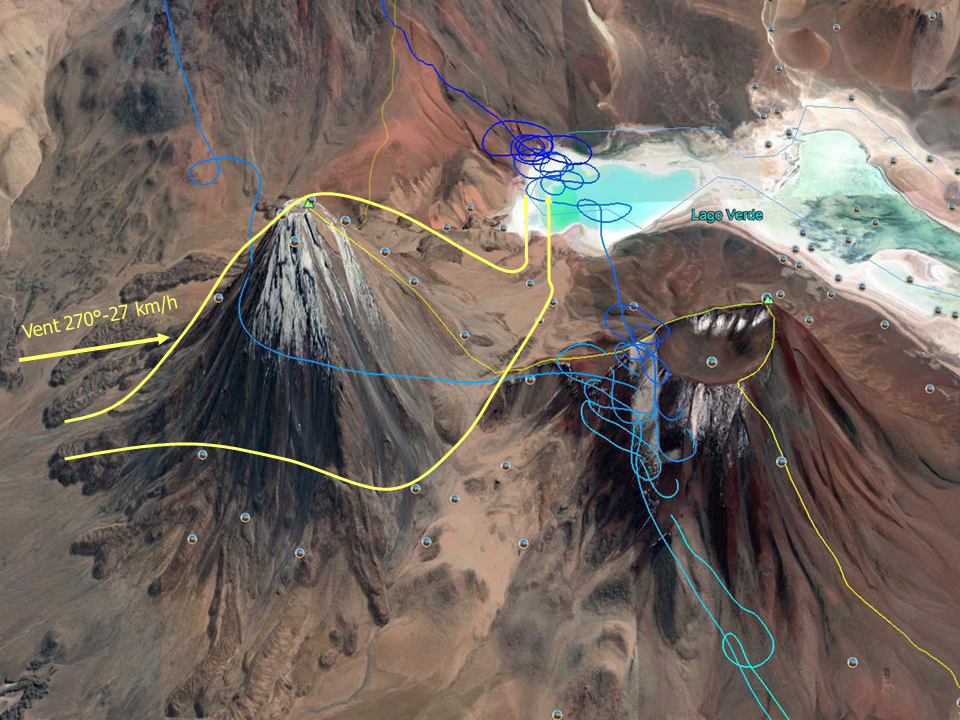

Track of the Nov. 7 flight out and return downwind of the volcano Licancabur, and photo. The white areas are not snow (we are at the Tropic of Capricorn!), but either rock salt, gypsum, sometimes borax, or a mixture of everything. We will almost reach the altitude of the top (5,916 m) and continue our journey by tickling all the volcanoes in their convergence area, and all will work. It was not strong but much safer than the rare pure thermals which never allowed us to reach 1,000 m AGL. About the ground, totally unlandable and without any human life, it is better not to look down and just maintain the safe glide path to the nearest airport. For my “legal” pilot, a youngster who just soloed in April with 40 hours, this ride was the flight of his life, especially since I wanted to leave him controls as much as possible.
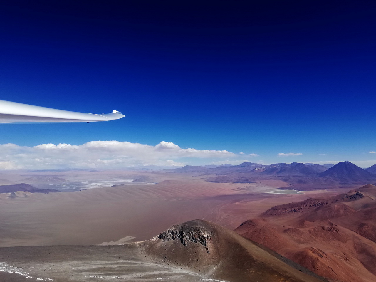
View of the Bolivian Altiplano from approx. 6,000 m at volcano Licancabur. The ground is between 4,000 and 4,500 m, no road, no trace of human life, no landing option. The splendid cumulus clouds with bases around 8,000 m are inaccessible, and flying over Bolivia is theoretically prohibited.
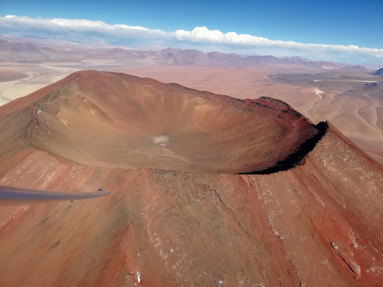
The volcano Juriques appears to be a block of copper. The crater is entirely Chilean, the border goes around. Its western slope is in phase with the convergence of Licancabur, which makes things easier.
Observe the degradation of the cumulus clouds at the beginning of the afternoon, called the Bolivian Winter, an entry of humid air from the Amazonian plain.
On November 11, I shall repeat this experiment with Jean-Pierre around the volcanoes San Pedro (6,130 m) and San Pablo (6,080 m), in a much more complex situation because we will arrive on the ridges with south wind 25 km/h up to 5,000 m, which turned west then north-east 15-30 km / h above 5,200 m. Consequenetly, we had to go back to the upwind side and climb in the northeast air mass, then go downwind again in this same air mass and go up in convergence. It was very complicated and, in any case, the north-eastern situations cannot be exploited safely because the air mass is hot and humid, coming directly from the Amazon, see below “Bolivian Winter”.
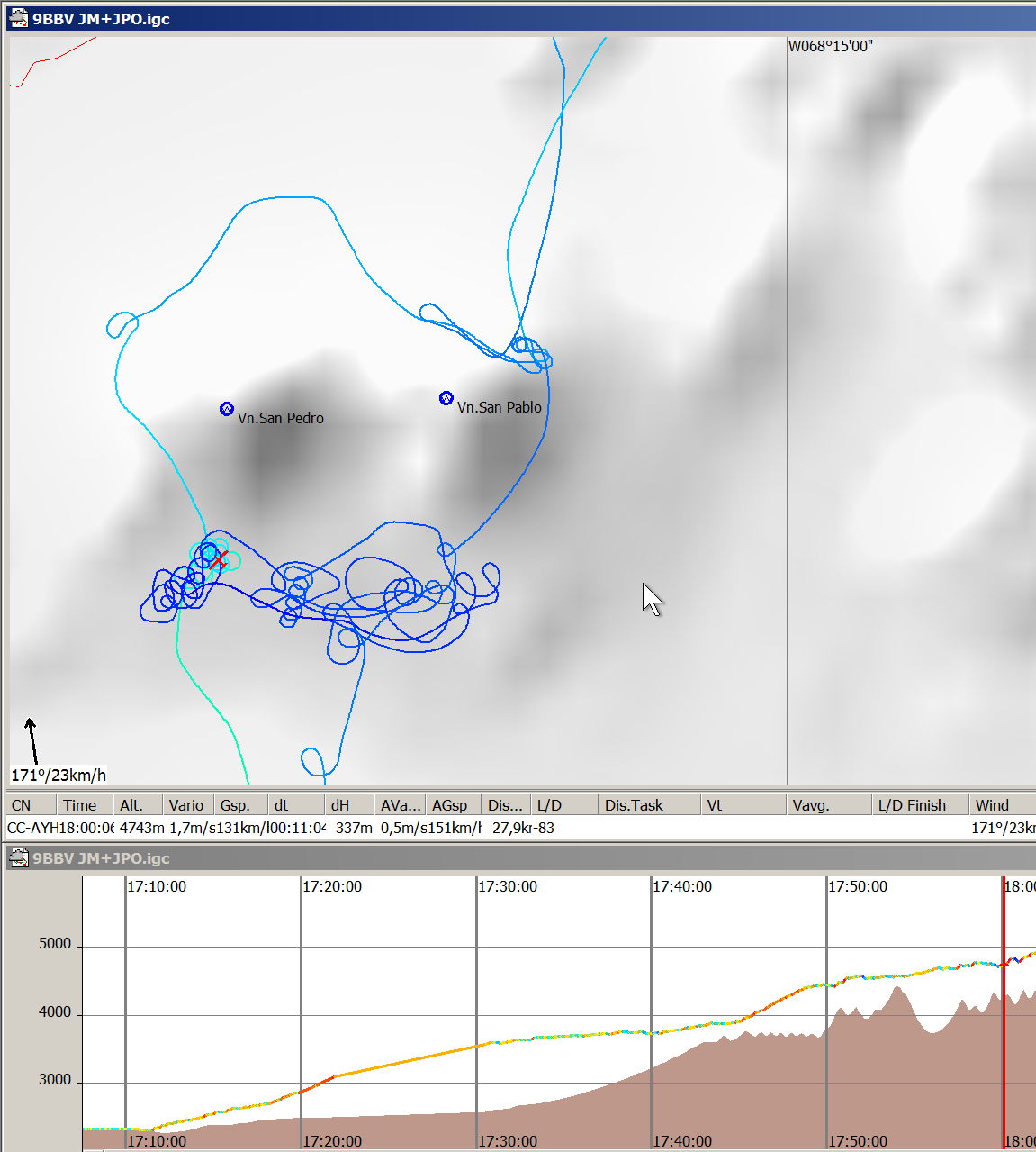
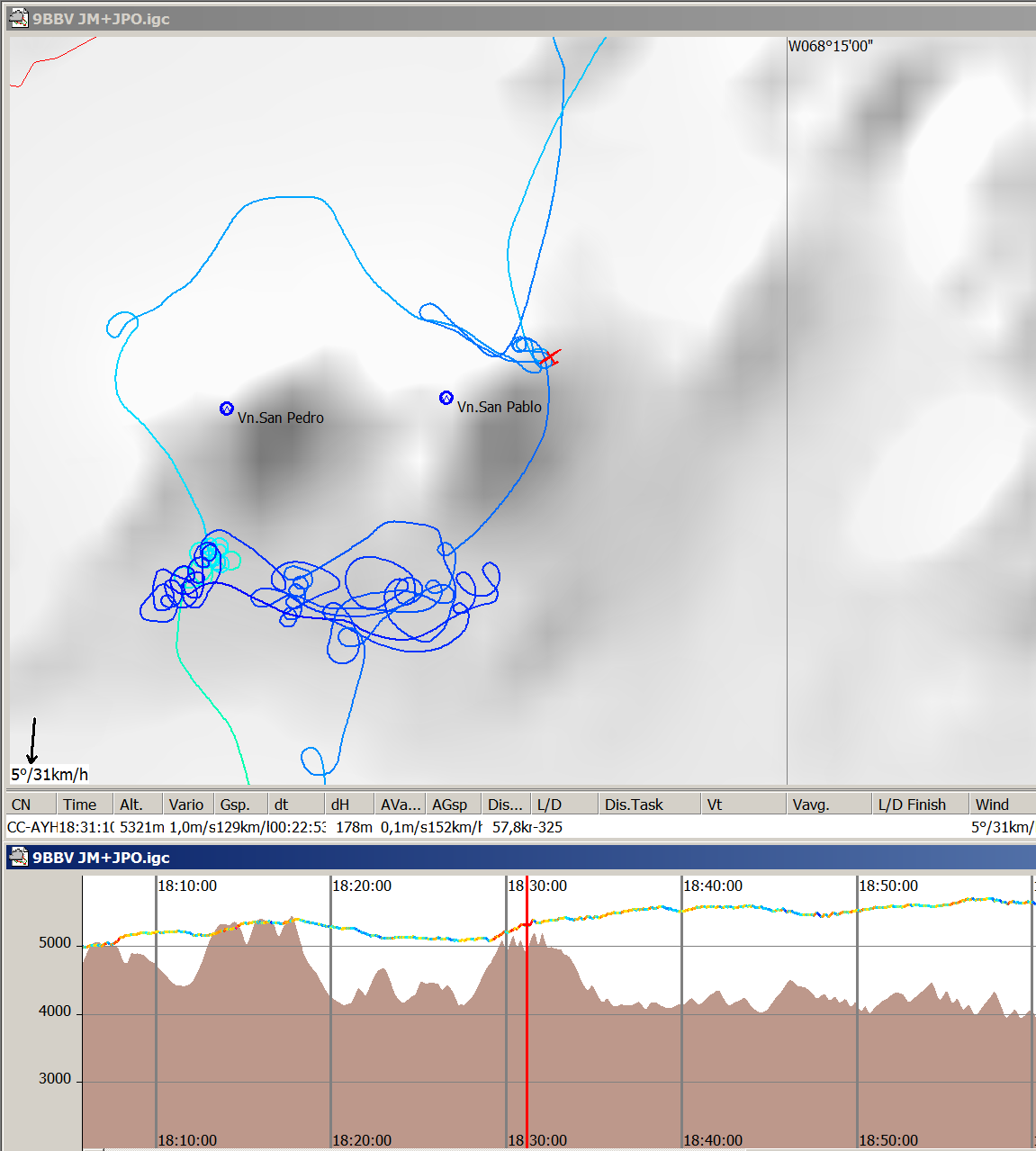
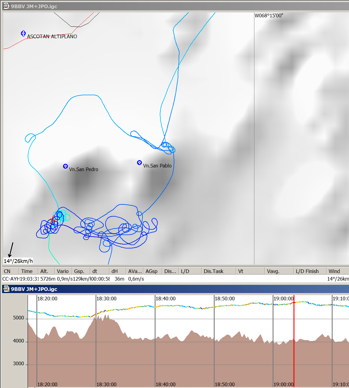
6:00 p.m. Climbing in weak thermal with the help of the engine by rising breeze Southern 23 km/h, which stops around 5,000 m while turning clearly to the West. Decision to turn around the volcano to the West side.
6:31 pm The west ridge does not produce lift, the wind turns to the North. At 5,300 m, attempt to work the North-North East ridge, wind 31 km/h. We just reach the top, helped by a thermal just in the crater. Many fracto-cumulus born and die quickly at our altitude, the sky is always overcast 8/8 by cirro-stratus.
7:00 am Back again on the lee side in search of the convergence wave, which exists but ends at 5,700 m, with a N-NE wind of 26 km/h. We are exactly at the same position as of our initial climb in thermal with south wind. Exactly as expected, but, as with all the convergences encountered during our expedition, we will not climb higher than the summit.
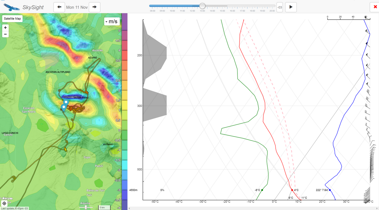
The post-flight analysis made by SkySight (“reforecasting” exercise in April 2020) clearly shows the 3 layers of opposite directions and the presence of a wave rebound by North East wind exactly where we found it. SkySight confirms that it was not possible to exceed 6,500 m since the wind was making a quarter turn at this level. The total cloud cover around 6,500-7,000 m is also confirmed. I had noticed the presence of likely wave clouds at the North East of the two volcanoes, but my (unsuccessful) attempt was just a little too much to the North. I did not insist because we did not yet know anything about local outlanding options, and SkySight was not yet fully operative.
The next day we will go with a 4×4 van to explore the region and discover the “potrero”, acceptable outlanding strip on the Ascotan plateau, which was even relaunchable. But for taking off at 4,000 m MSL with the good old Limbach, the passenger must stay on the ground and the fuel reduced to a minimum!
