The world speed record on 1.000 km out-and-return at 214,8 km/h
On the eve preceding this flight, the pilots had to anticipate their return to home because of the arrival of a front and strong rain, flying “only” a small flat triangle of 1.200 km in 7 hours. I had a lot of doubts about the time of the end of the crossing of the front and in fact it was still raining at breakfast at 7h30. But the situation improved and I proposed a speed task with one southbound additional point close to Esquel to close a 1.500 km flat triangle if the conditions permitted. The centres of pressure were in the right place with a good low pressure centre located on the Atlantic ocean (Fig. below) generating a good “pulled” flow.
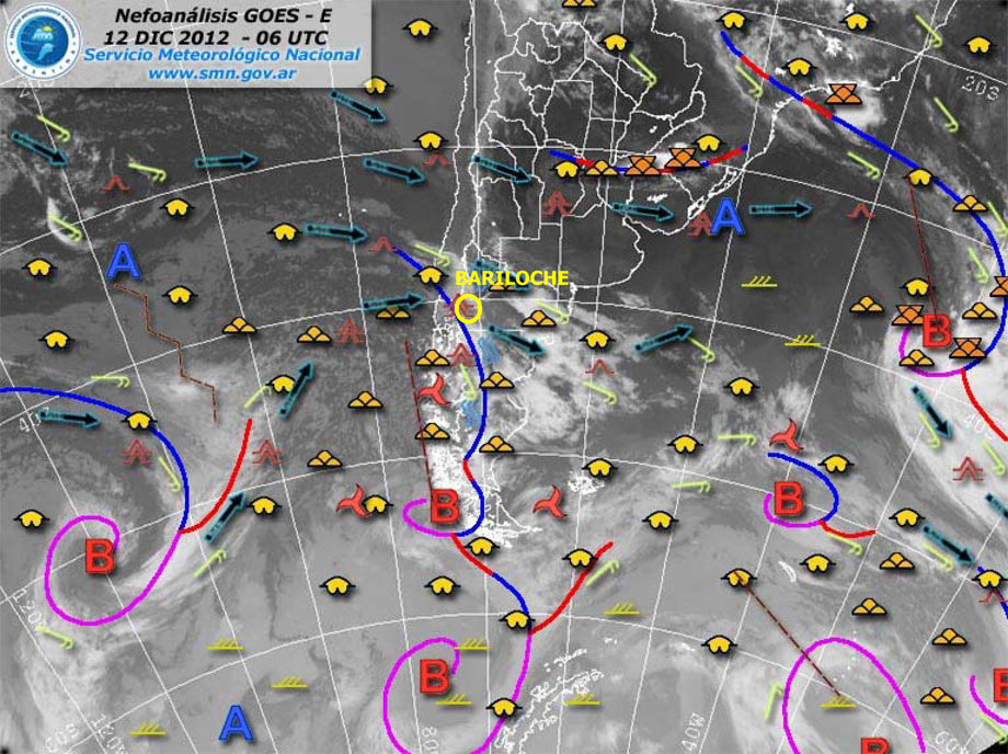
| Nefoanalysis December 12th at 3h LOC |
Only drawbacks: the front should limit the flight to 200km to the south (Fig. below) and the wind should turn NW around 600km to the north.
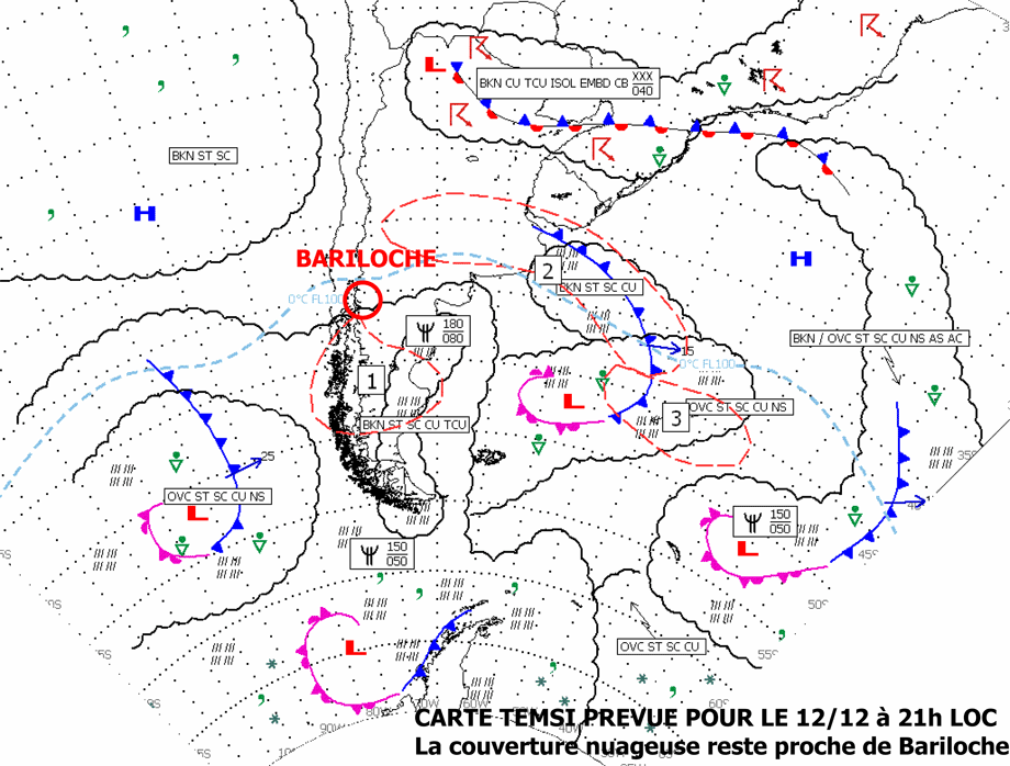
| TEMSI December 12th |
The play ground was nevertheless more than 800km long! I am quite conscious that this course is far from being the best for this type of task because it is necessary to twice cross the wake of the Lanin volcano, which breaks up the organized rebound wave system. An ideal start would have been from near Zapala, 250 km to the north, but that would have brought us to an area where wind would have turned northwest according to the forecast, therefore less favourable.
I make the mistake of losing six minutes in the wake of the volcano Lanin, hoping to climb, but without success. The front has encroached deeply into the valley of Zapala and it is necessary to continue downwind for 25km to find the first rebound at only 3,500m QNH (2,300m QFE), in reach of the nice runway of Las Lajas. During this transition with 136 km/h of tail wind, the calculator shows a ground speed of 448 km/h, my personal record.
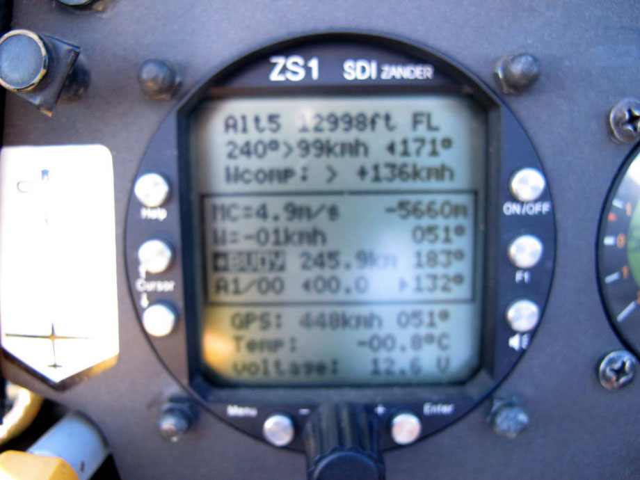
Tail wind above Catan Lil gives 448 km/h ground speed at FL130.
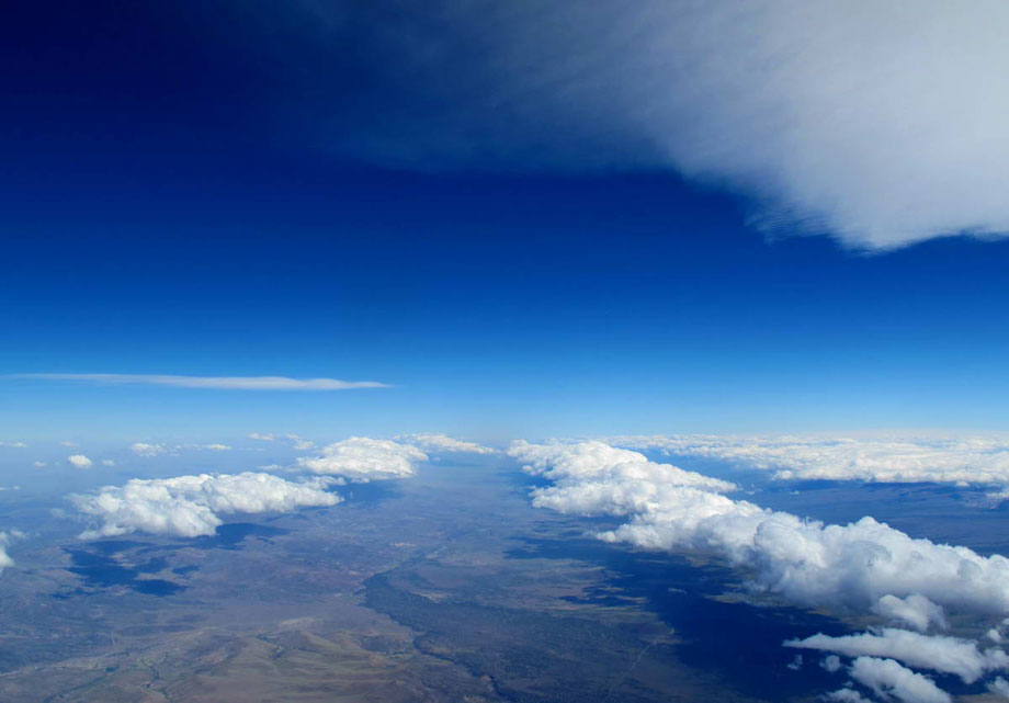
From that point, the system is well organized with beautiful rolls for 150km, the junction with the valley of the Cordillera del Viento is all in lift and we arrive there at 5.200m, which is 1,000m too high. Finally the delirium begins as per the most beautiful days, it is necessary to accelerate “full steam ahead” during 200km in an initial netto of +11,7 m/s (photo). I observe that the wind speed is less strong (90-100 km/h) and better orientated (260-270°) at high altitude than below 5.000m. It is necessary to optimize the netto to maintain the highest possible speed to exploit these advantages, that makes us play for long time around the Vne between 7,000m and 8,600m (244 km/h IAS). The photo below (at turn point looking south) shows the sky that awaits us for the first 200 km on the way back, not extraordinary but sufficient.

Netto +11,7 m/s at the Vne in the Cordillera del Viento valley
The key to the speed record was the track between Zapala and Chapelco, 120km without any marked rebound, wind ¾ in front but less strong at high altitude, 100-110 km/h against 130-150 km/h below 5,000m. We lose 4,000m as expected, without reducing the speed, with a steady Mc setting at +5 (the maximum allowed by the ZS1 computer), flying even faster than requested, managing manually the trajectory to reach the rotors of the Chapelco volcano at the altitude of the clouds, where the lift is maximum, thus converting lift into speed.
Rotors downwind of volcano Chapelco towards Bariloche. Between the two bars, the valley of the Rio Collon Cura. This rotor is an 80km long “tube” that brings us back on the finish line of the O/R at 17h20, ready to head South to the next TP. The crossing of the plain toward the next point to the South is made on tiptoe because the front enters exactly as foreseen beyond the international airport of Bariloche that we must fly round by 20km East. At the end, the enormous rotors and lenticulars of Esquel invite us to begin the final glide at 250km and 3,600m below the glide path at an average speed of 295 km/h. World Record broken and at least 4 US records, in spite of my mistake that has cost 6 minutes. Happiness for Philippe! And congratulations to the weather forecaster.
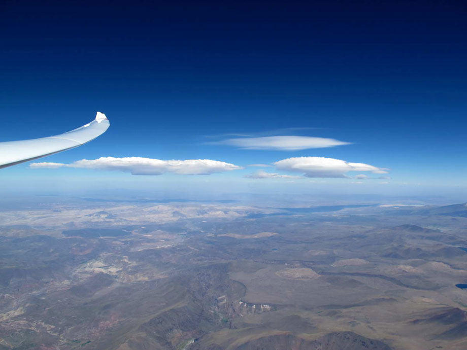
The sky of the way back seen from the turn point of the O/R 1.000 km
Rotors downwind of volcano Chapelco towards Bariloche.