The topographic profile below stops at the Bolivian Altiplano, La Puna, whose average altitude is around 4,000 – 4,500 m. The airport of the capital La Paz, to the right of this sketch, is at more than 4,000 m. This plateau slopes gently towards the North East, towards the plains of Amazonia, first Bolivian then Brazilian. By observing the flows in the lower layers, I noted that, under certain conditions that only SkySight was able to predict, the Amazonian hot and humid air mass rises on the Bolivian Altiplano up to the chain of volcanoes, which it reaches in the early afternoon, and it is the end of our beautiful cumulus. Luckily, we were in spring, but in summer, in February, cumulonimbus clouds can give rise to catastrophic precipitation, as was the case in 2015 when even Calama was flooded.

Therefore, first cumulus above volcanoes around 10am, visible from Calama, 100 km away, the time that the QFU turns back to 28 to allow takeoff with the S10, one hour of engine to get there, a little trip and it is 2pm, it’s beginning of the end. No need to wait for the cumulus to degenerate, we realize this immediately because the wind turns NE above 4,000 – 5,000 m.
Luckily, in this season, the Bolivian air does not exceed the line of volcanoes and the Cordillera of Domeyko remains safe, the cumulus clouds are healthy but do not allow to go far, the panorama is that of the desert on one side and the Atacama Salar on the other, much less interesting. In conclusion, the days of pure thermal were welcome, at least the air mass in the weak western flow was homogeneous and remained healthy throughout the afternoon.
The photos below illustrate a typical Bolivian winter situation seen from the ground near San Pedro, looking towards volcano Licancabur, enjoying a visit to the Moon Valley (Cordillera de la Sal) in San Pedro, between 11:29 am and 1:47 pm.
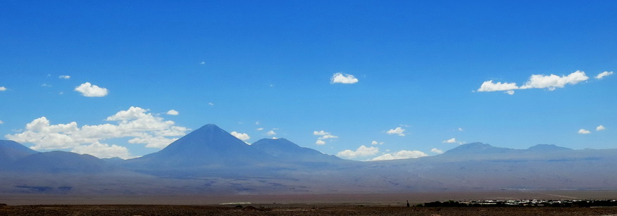
11:29 am The sky is splendid, cumulus clouds isolated around 7,000-8,000 m. The village of San Pedro is visible on the right and Licancabur (5,916 m) in front of us. We still cannot take off from Calama because of Easterly breeze (QFU 10, runway going upwards 60 m, not for us).
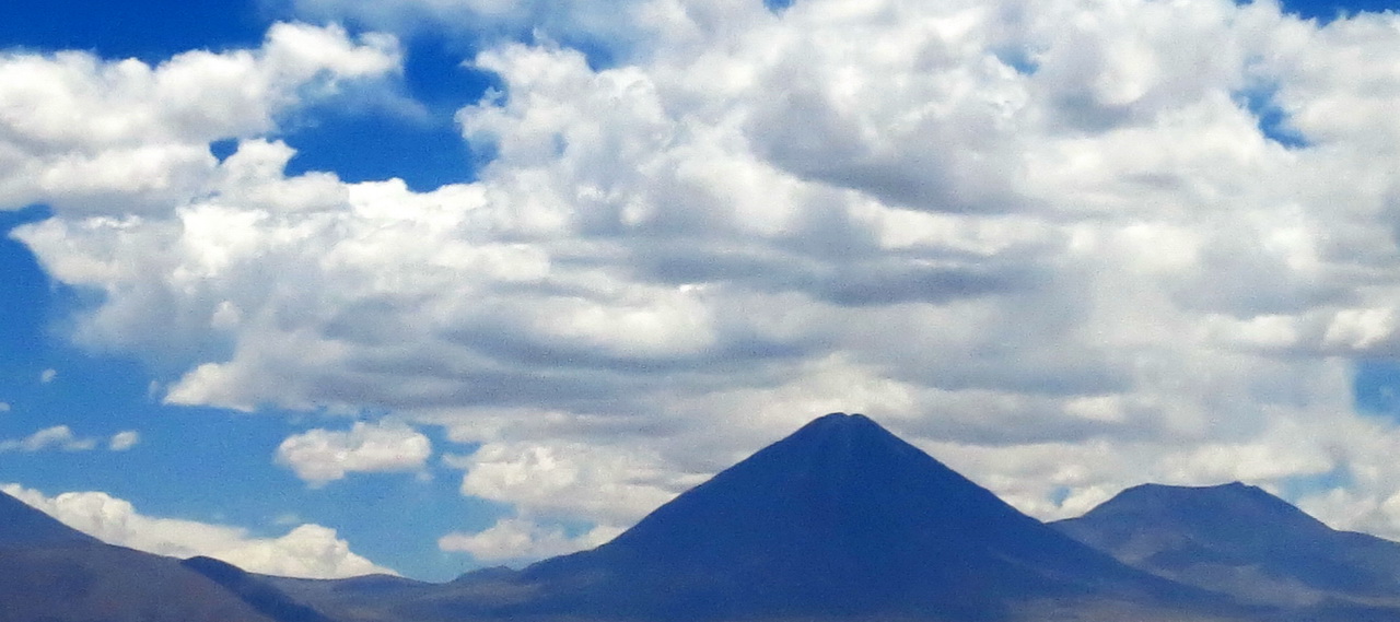
12h26 In one hour the sky has totally changed, going from 1 to 4/8 Cu, the bases are still between 7,000 and 8,000 m but some are starting to fall into filos, fraying.
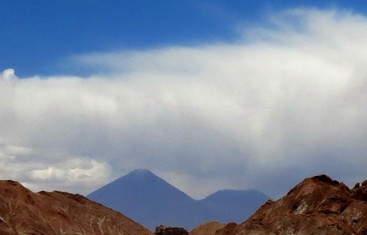
1:21 p.m. Within an hour, Licancabur has become unflyable, the sky collapses. Still some possibilities to find some “living” cumulus towards the North, while keeping the airport in sight
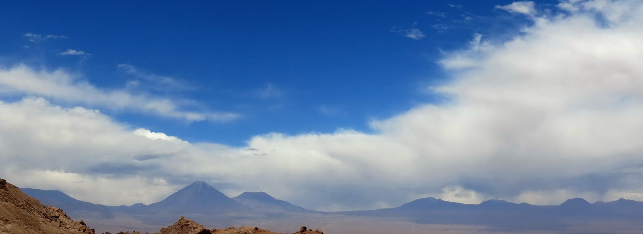
1:47 p.m. Game over. This pattern will repeat itself whenever the circulation from the west at altitude is weak, allowing humid Amazonian air to enter the Altiplano.
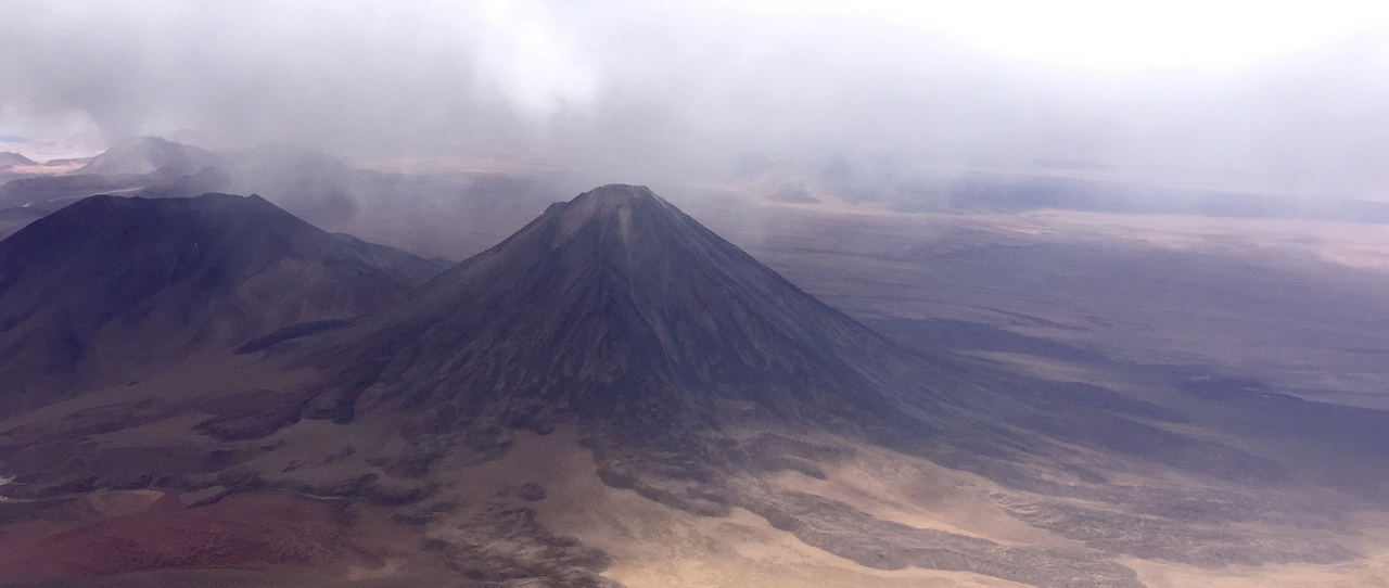
The same situation seen from 7,000 m looking towards Licancabur and the South West from Sairecabur. U-turn to home.
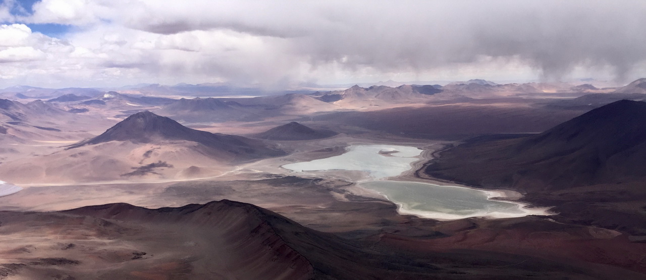
The same situation seen from 7,000 m looking towards the South and the Laguna Verde (Bolivia then Argentina). The center of the Altiplano seems still active, but not for long.
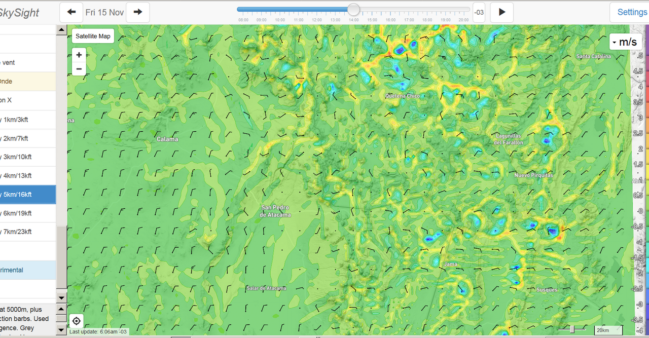
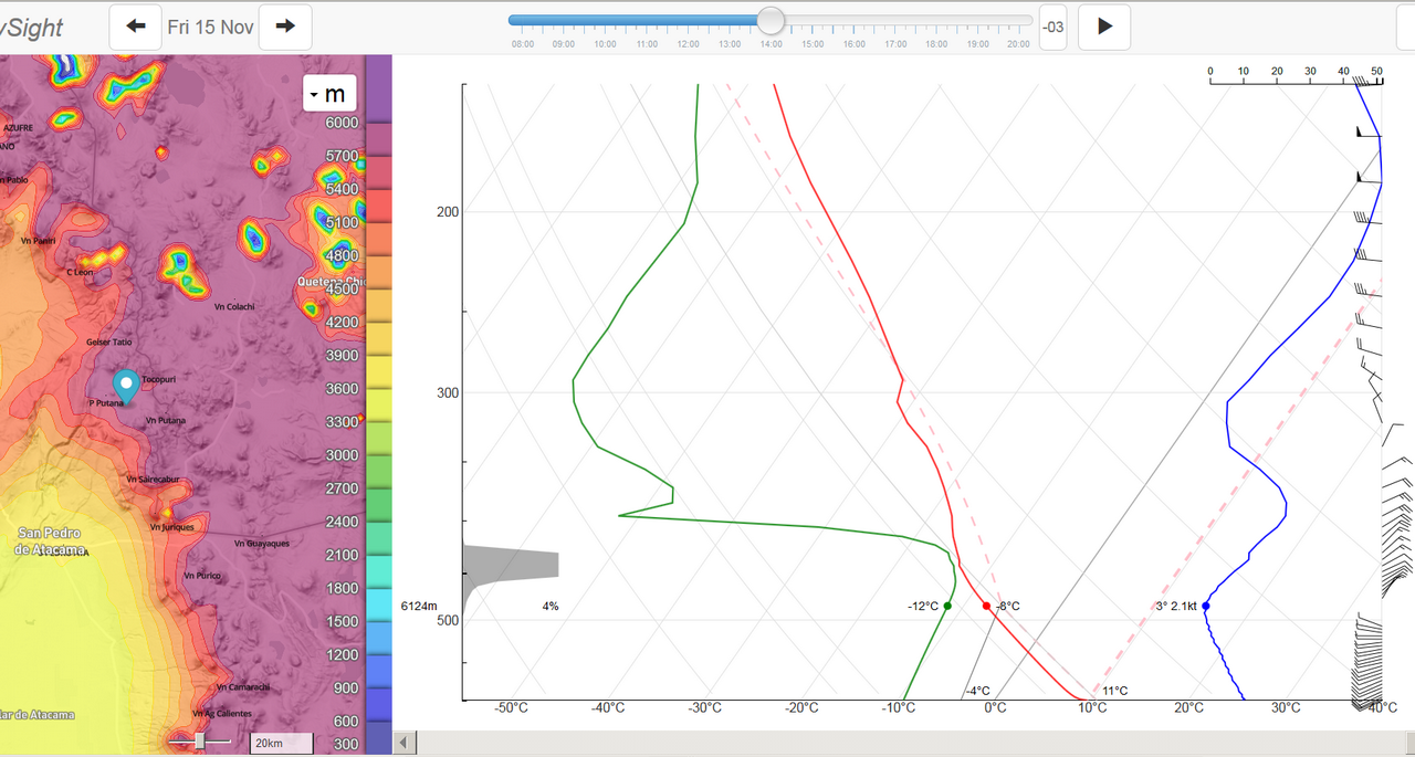
November 15th is a typical situation. While the 500 hPa geopotential map shows no sign of flow (identical to that in chap. 15), observation of the 5,000 m wind map below shows not only that there is a little north circulation on Atacama, approx. 5 kt, but also a rotation of the air mass flow to E-NE, still 5 kt but over the whole of Bolivian territory. It is a small thing, but enough to allow the entry of humid Amazonian air. As already said, in this country, we have to watch carefully the weak signals.
On the other hand, the Skew-T diagram provided by SkySight below is categorical and it is not a weak signal: between 5,000 and 6,000 m at the volcano Putana, the wind changes from W-NW to E-NE but in particular, there is condensation. At higher altitudes, the air mass appears healthy and returns to west circulation above 7,000 m. So possibility of continuing the flight by looking for open areas. My report of the day says this: “Always between two H’s on the Pacific and Bolivia with a local L on the Bolivian altiplano, which generates a strong daytime suction coming from the desert (and sea) with formation of Cb at noon. Cu very early in the morning (9 am) on all the volcanoes, then collapse starting around 12 am, the Cu whose base is at 7,000 m become Ci and reduce insolation. The cycle resumes, however, with new mini Cu, and a few fractos materializing a convergence between the Bolivian air mass pushed by a light E-NE wind 20-25 km and the opposite rising breeze.” NB: the temperature values of the diagram are 10 to 13 °C lower than the reality. We have never had a negative temperature at 6,000 m.
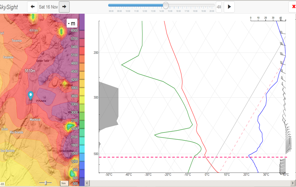
The same Skew-T map (below) from November 16 is even clearer, the wind turns around in a few hundred meters between 4,800 and 5,000 m, then condensation over more than 3,000 m in height. Tourism day! My report of the day says this: “Cu very early in the morning (9 am) on all the volcanoes, then collapse starting around 10:30 am and total coverage by anvils or spreads from 2 pm. No flight. “
The cycles of these situations last from 3 to 5 days. Similarly, situations where flow is westerly over the entire territory, favorable to thermal and/or waves of all types, have a similar duration, in general, the best part starting around the 2nd day. But everything remains to be discovered. If we re-launch an expedition, we will have to negotiate with SkySight to have a 5-day forecast with the Skew-T curves.
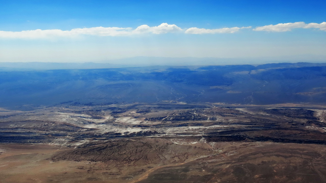
Regardless of the presence of the Bolivian winter, it should be remembered that at this latitude (22 °), the thermal activity stops abruptly and quite early, it gets dark at 8 p.m. Cumulus clouds may still be present but lift is not granted. Frayed bases are a sign that the lift will soon be switched off. The photo below, taken abeam San Pedro, shows in the foreground the Cordillera de La Sal, an ancient dried-up salt lake “turned almost vertically” by geological surges between -70 and -50 million years ago , and in the background the Domeyko Cordillera, same age, thermally active, cloud base close to 6,000 m and the col Paso Barros Arana (3,430 m). This is the guarantee of the return to Calama (flight of 21/11). It’s 4 p.m. and the clouds are starting to fray. The horizon line is in fact the copper mine of Chuquicamata and Calama is at its foot, 100 km away.
