I launched the “Atacama” expedition in the hope of bringing back memorable souvenirs about “volcanic” thermal under cumulus. In fact, we’ll be living in the “Bolivian winter”, technically the altiplanic winter, which kills our beautiful clouds at 2 p.m.
In short, I feel a little like this Genoese navigator who was looking for the Indies and found America. Instead of volcanic thermals, I discovered a new expression of the gravity wave, which I quickly named “the tropical wave”. It now remains to understand how to explain it and share it with my passionate companions.
We will therefore report good surprises concerning the wave phenomena that nobody expected, convergence waves, jump, hydraulic “Bidone” jumps. Certainly not to make big numbers in terms of kilometers, at least for now, but for the pleasure of the eyes and the comfort of the crew, we cannot do better, the potential is immense.
Before leaving to Chile, I asked the pilots in Santiago what temperature we should prepare to fly at 7,000 – 8,000 m in the tropics. I was told “-20 ° C”, hence a whole case of flight suit, heated socks, overboots, gloves, etc. What a mistake ! To my surprise, Jean-Pierre, for the first flight with me, left barefoot in his hooves (photo). He never changed, he just added a pair of light socks for days of doubt. Luckily, the canopy of the S10 allows you to have sun on your legs, but even at 6,000 m, the temperature has never been freezing. The maximum of the surprise was during the last flight, at 8,000 m in a short-sleeved shirt as in European summer in thermal (photo). About turbulence and rotors, they were completely unknown at any altitude, even near a materialized rotor. Just a few quivers at the bottom when the wave movement starts to take place, around 500 m AGL (5,000 m AMSL).
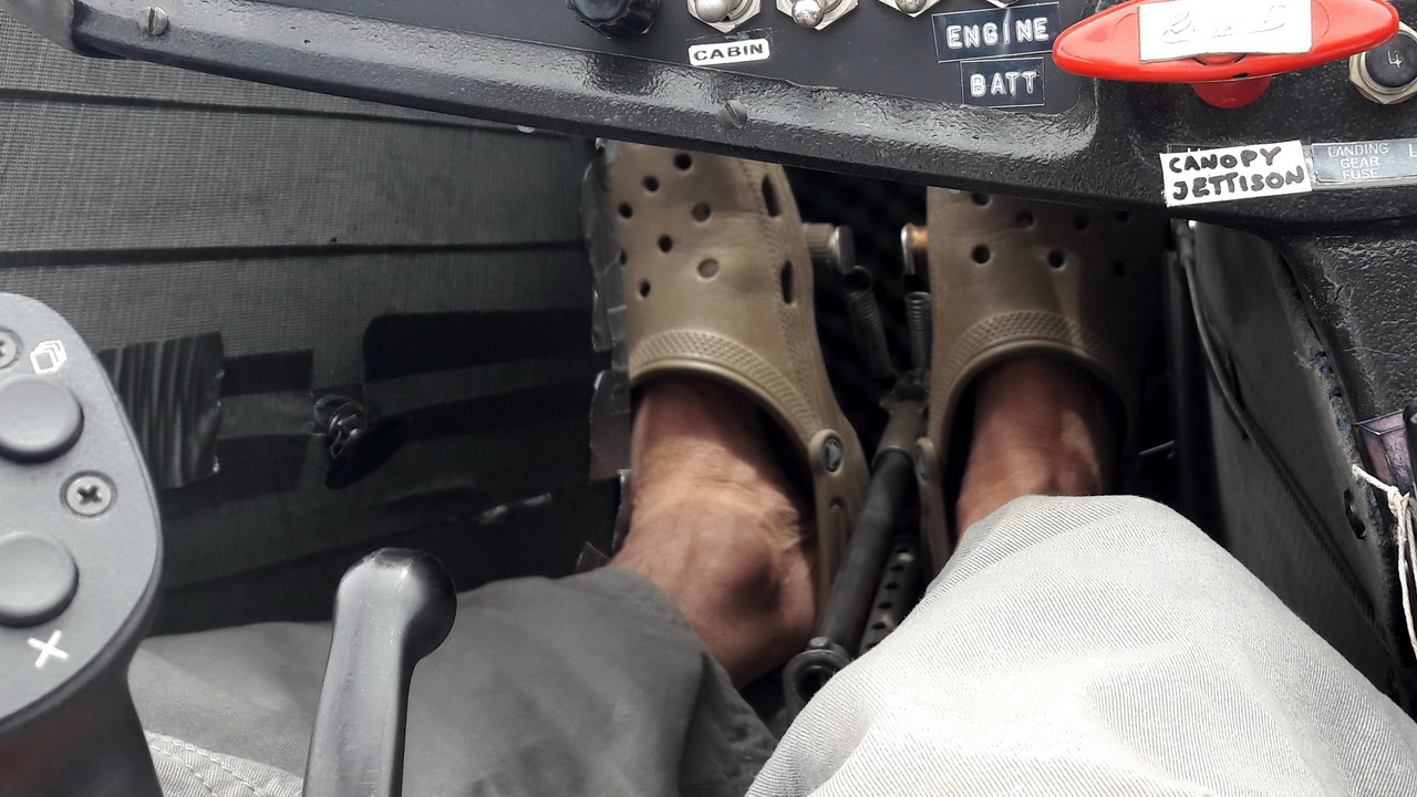
Jean-Pierre wearing his “Croc’s” at 6,000 m. We have never seen a freezing temperature at this altitude, rather between +3 and + 5 °C, and as the sun heats the feet with the parabolic effect of the canopy, it is very pleasant.
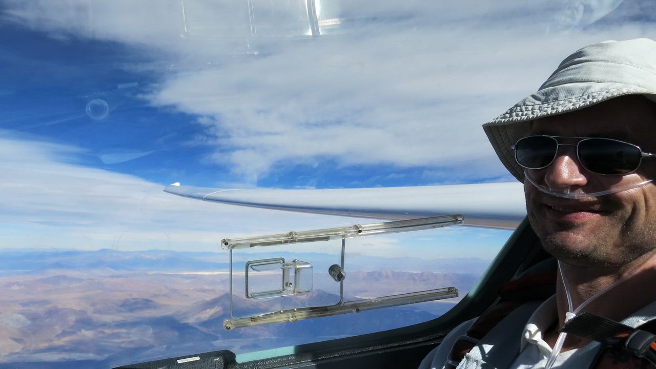
Gerhard in a shirt at 8,300 m, apparently very satisfied. Outside temperature was -10 °C but the parabolic roof heats up so much that the ventilation must be opened fully.
This personal designation “Tropical Wave” is undoubtedly inappropriate because it can lead to confusion with that well known to meteorologists, defined by Wikipedia as “a barometric trough (or talweg) of the tropics which can lead to the formation of tropical cyclones. This hollow in the rectilinear air flow arises when the intertropical convergence zone goes up towards the pole in summer in a hemisphere… So a tropical wave is a line of violent thunderstorms formed by storms at the base. No relationship with ours.
As we have decided to deepen our research on the causes and methods of materialization of this phenomenon, in collaboration with international experts, we will no doubt have to find another name. I will gladly receive any proposal!
How to characterize this phenomenon in few simple words? The more complicated ones are the subject of a study which will be published at the next OSTIV congress in July 2021.
- You leave the restaurant quietly after lunch. The temperature is pleasant, between 25 and 30 °C at 2,400 m, there is no wind on the ground, the sky is of a blue which we make postcards, you sit comfortably in the same dresses as that of the restaurant and take off toward the volcanoes.
- 30 minutes later, you are 5,500 m on the ridge, the rising breeze is only 15kt and is not sufficient to climb.
- You turn around the volcano and go to the lee side, catch the lift and leave around 7,000 – 8,000 m because the oxygen delivered by the EDS is no longer sufficient.
- The wind at this altitude is only 30 – 40 kt, which is very little considering the increase in glider performance, your L/D has increased by 1 or 2 points but at a speed 40% higher, it is enormous! Your maximum L/D is now around 165 km/h (92 kt) TAS. Watch carefully for the Vne which is only 195 km/h (108 kt) indicated for the S10.
- You travel downwind of the alignment of the volcanoes and you fly for hundreds of km without worrying about the wind.
- If you are lucky, lenticular clouds can form, but they are inaccessible, between 10,000 and 12,000 m. Possibly some cumulus-rotors absolutely calm will tell you where the best lift is.
- In general, the higher you fly, the stronger the lift. We observed up to + 7.6 m/s (15 kt) at 8,300 m, that it was necessary to abandon for insufficient oxygen flow (we would need a pressurized breather).
- If you are no longer 20 years old, don’t forget to set the EDS to the maximum flow rate (F20 or F4 depending on the model) and watch the pressure carefully, because below 70 bar (1000 psi) you have less than one hour, which is just what it takes to get back home! Re-read chapter 12 of my book “Dancing with the Wind”.
- Quiet landing, with maybe 10 kt of wind in San Pedro, or 15-30 kt in Calama, but well aligned with the runway, no problem.
It’s not more difficult than that, it’s within everyone’s reach, once you understand how it works.
Of course, our oxygen distribution system does not allow to climb higher, and even at 7,000 m, you are only 2,500 m above ground. This allows you to admire the landscape. Remember, the usual cylinders, even filled to their maximum pressure, give approximately 4 hours of endurance, and again, for young and healthy pilots. To be solved for the next expedition.
But the show is worth it! Some souvenirs below, the files of the significant flights are downloadable in the section “Flights and Records”.

You leave the restaurant quietly, you sit comfortably in the same dresses as that of the restaurant and take off towards the volcanoes, an hour later you are at 8,000 m.
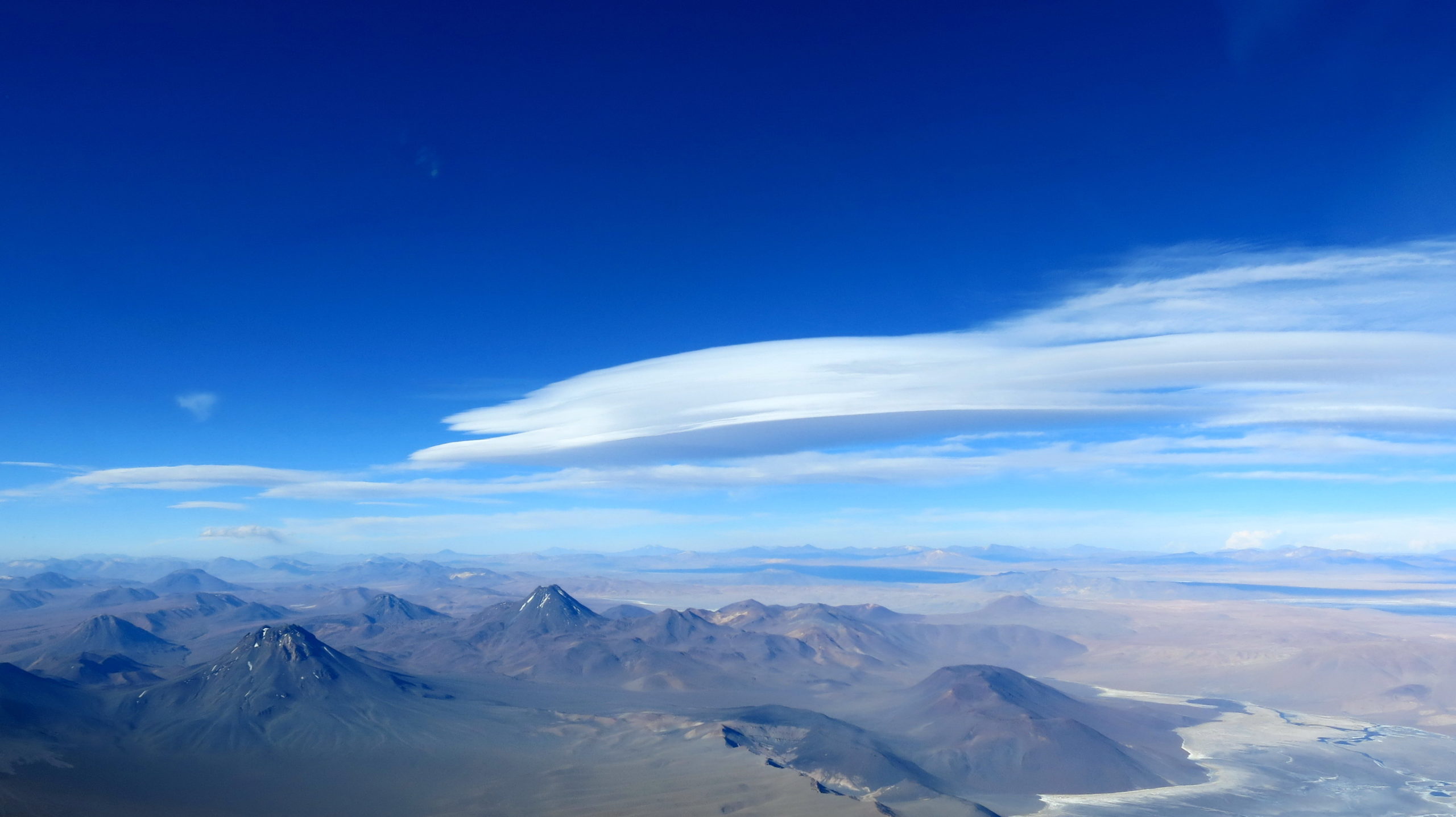
Seen from the sky, another day, looking northeast, same shape. Entirely in Bolivia and too far away, no chance. Oxygen equipment should be available to climb at least 10,000 m safely.
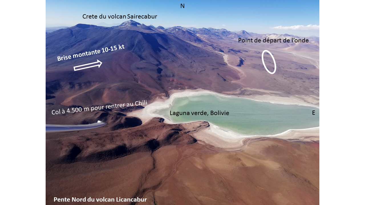
Position of the “standard” point to take the wave at the start as well as at the return, to grant at least 6.500 m in order to have L/D 25 on a final glide 100 km above unlandable terrain.
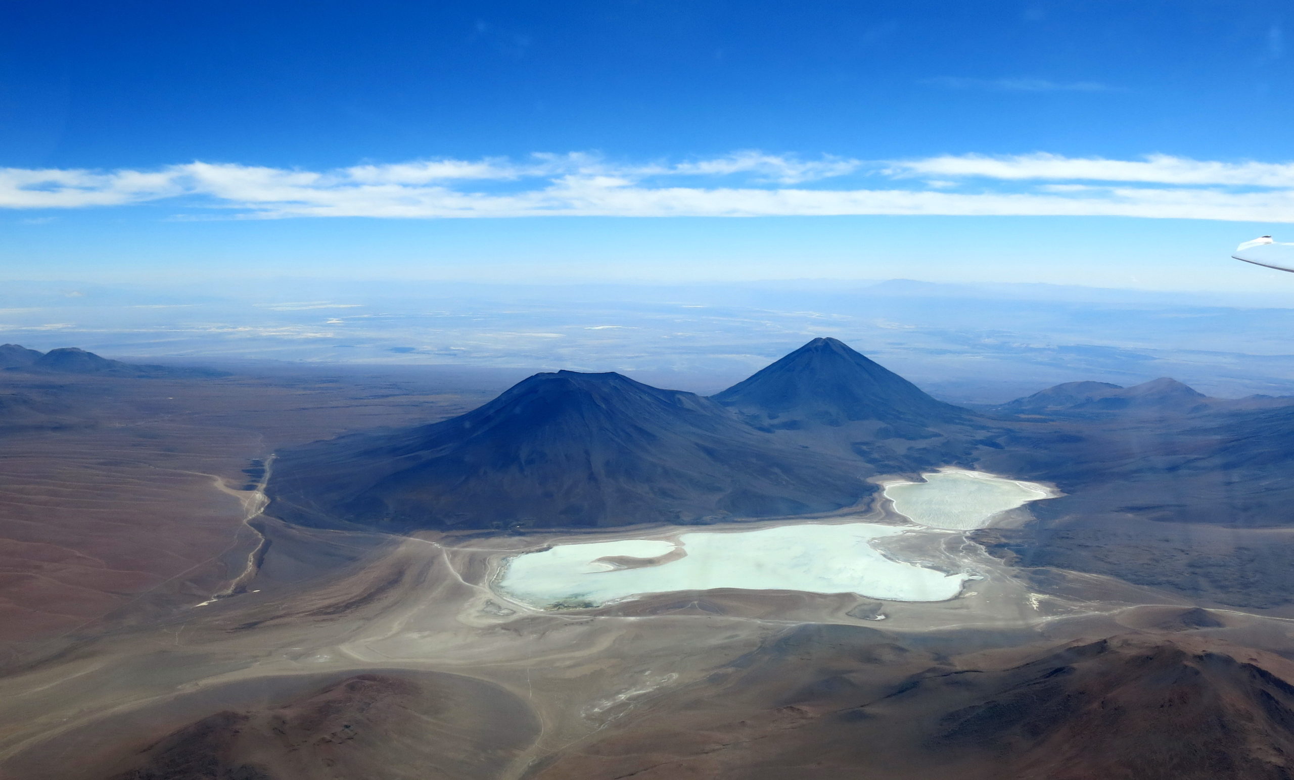
These same strategic points and the pass (4,500 m) at the end of the Laguna Verde, the crossing of which makes it possible to reach the aerodrome of San Pedro, visible at the end of the right wing. The two volcanoes are Juriques (on the left) and Licancabur (on the right). Photo taken 16 km inside Bolivia. The route visible around Juriques is that of Portezuelo del Cajon, 4.480 m, but there, there is a border post with armed guards, it is the starting point for the classic pedestrian ascent of Licancabur by Bolivia. The first lake, the Laguna Blanca, is full of salt. The second, the Laguna Verde, is filled with borax.
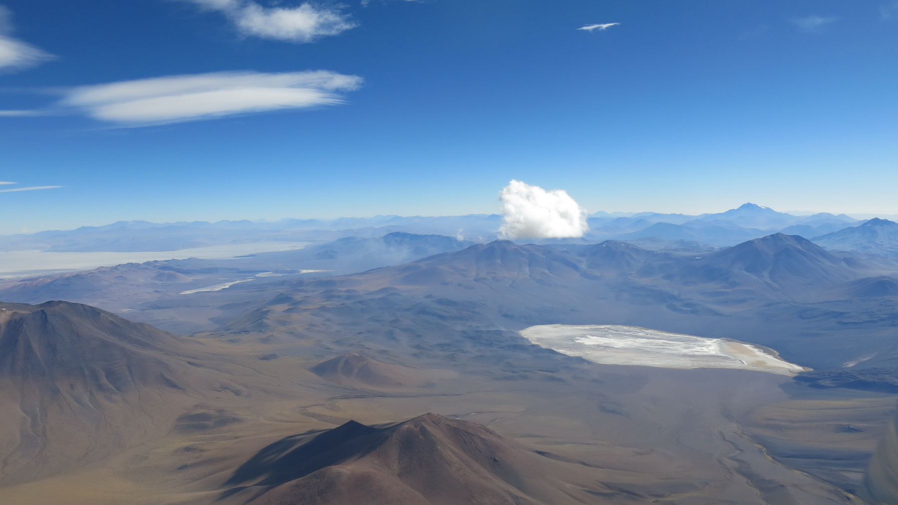
Is that a cumulus or a rotor? In any case, totally laminar, base around 7,000 m.
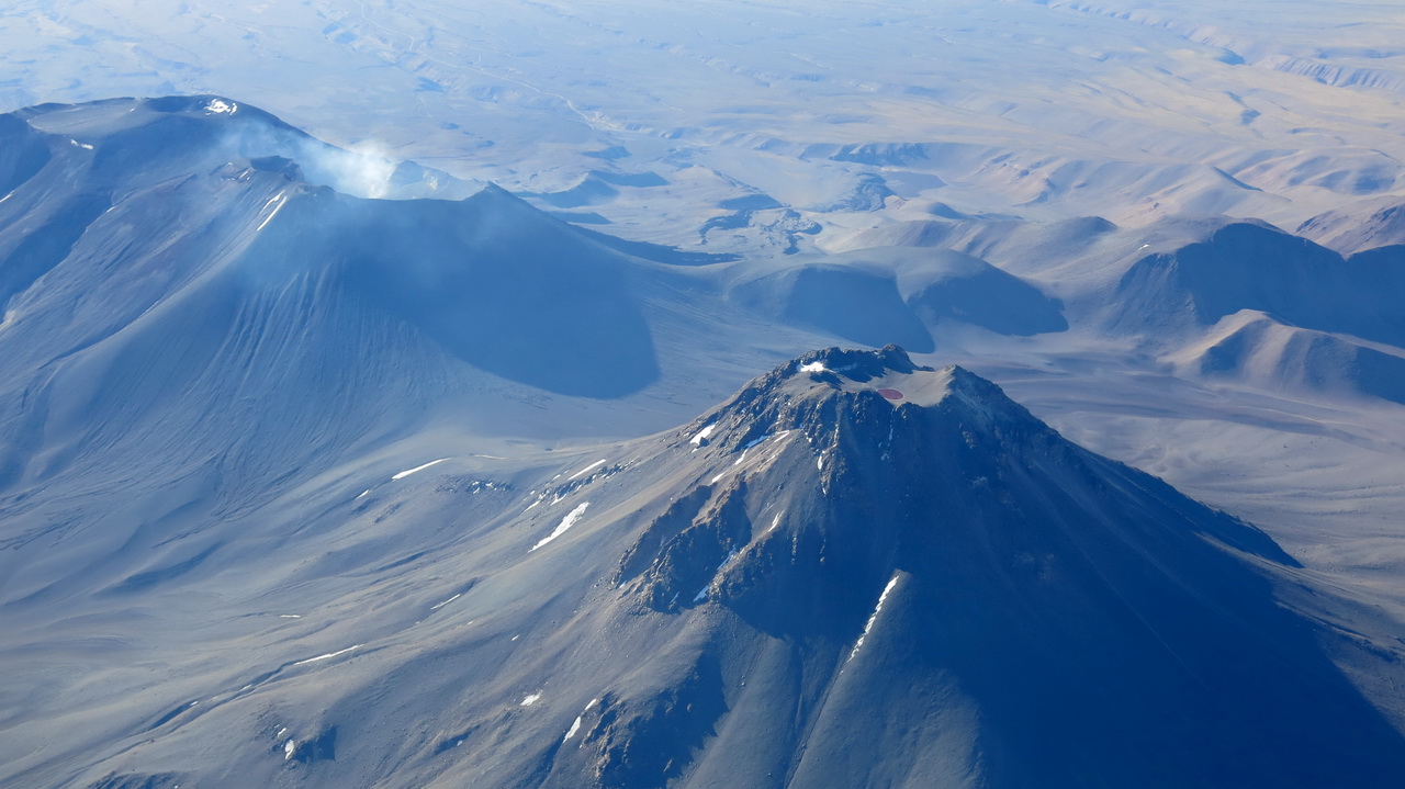
On the left, the volcano Lascar, still active, which we decided not to overfly any more because it is too dangerous. On the right, the volcano Aguas Calientes with its characteristic red crater lake.
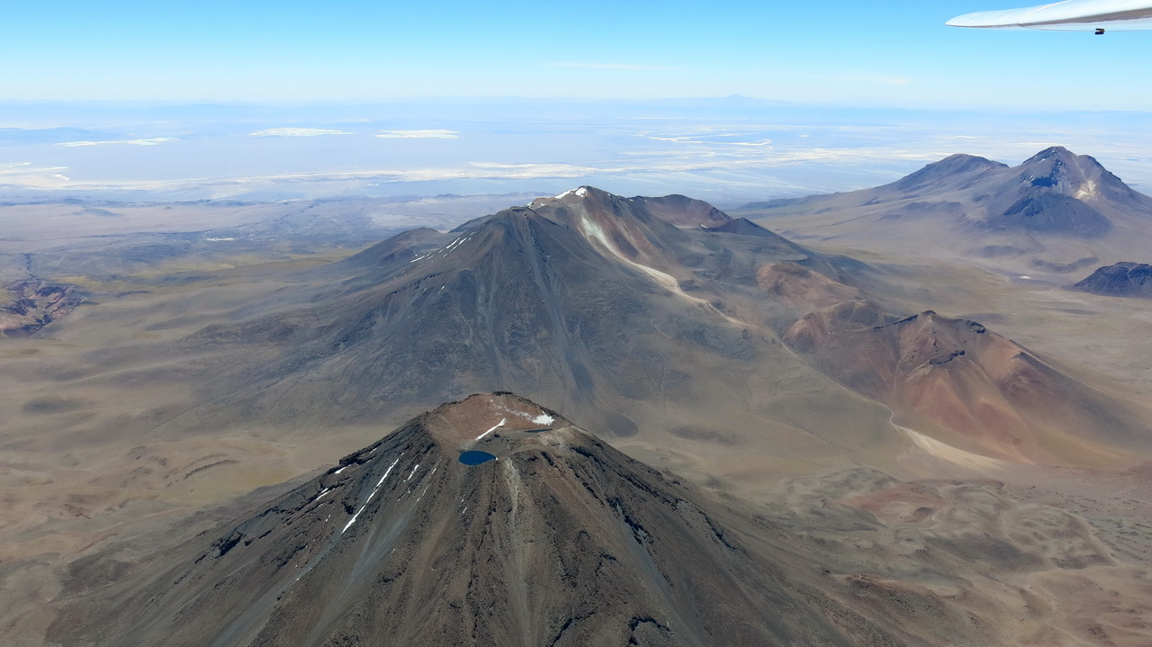
The Laguna Azul [Blue Lagoon] of the volcano Chiliques. The Atacama Salar with San Pedro is visible in the background.
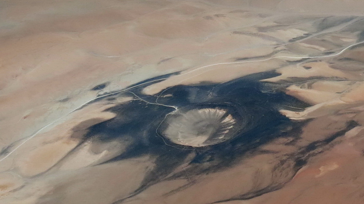
During my last flight, I passed by chance over this meteorite crater (23°31′-67°39′), fallen 56 km south of the ALMA radio telescopes. The Atacama Desert is an inexhaustible source of meteorite fragments, San Pedro has a museum where 3,000 pieces are kept, more than 100 of which are accessible to the public, which you can touch and listen to! These pieces are several billion years old, in this desert which is 200 million years old… .. They are probably at the origin of life on earth. We are very little.
