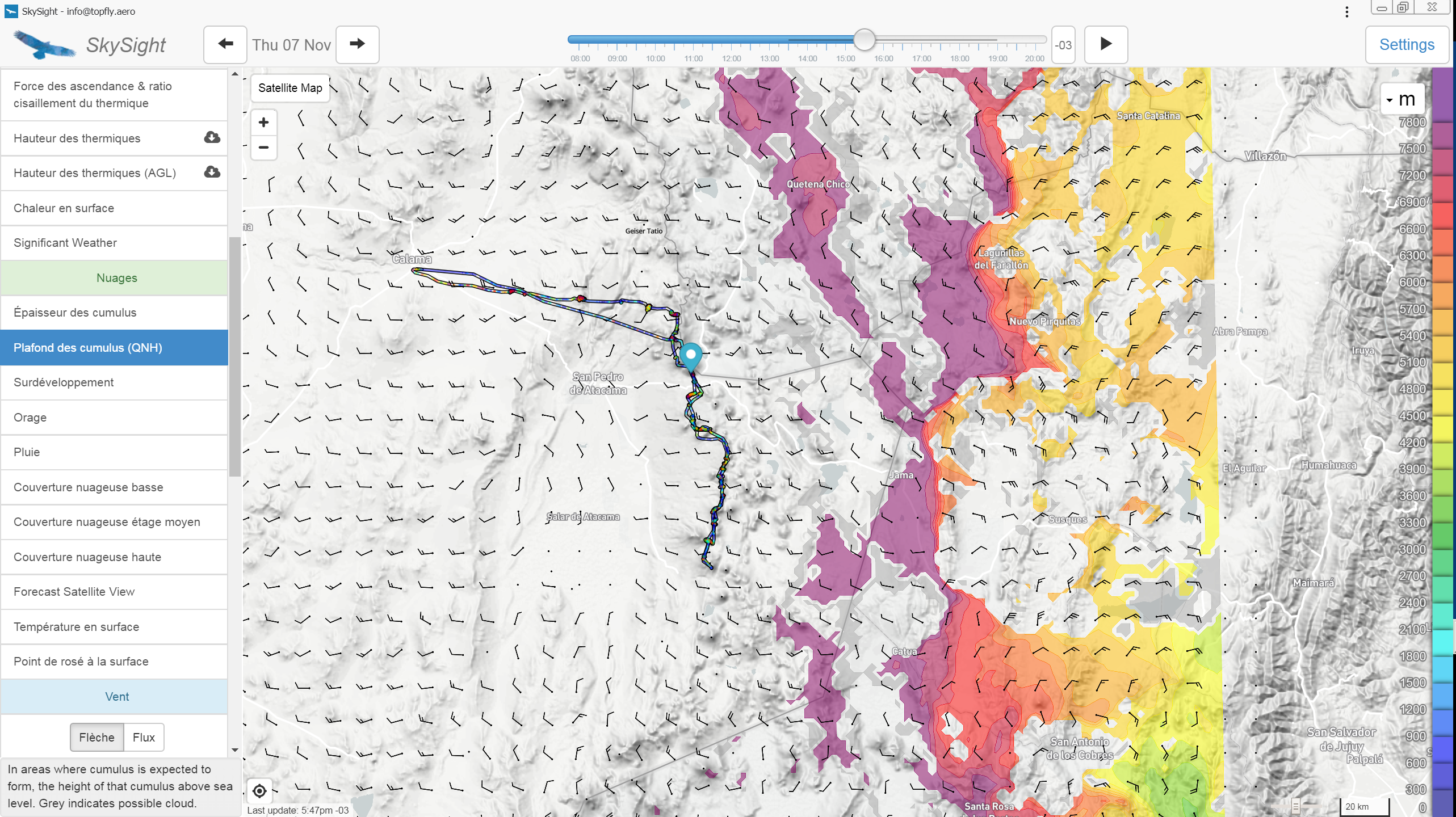
Was particularly successful, even if it took ten days to run in the system, ceilings of 7,000 to 8,000 m in thermal (most often blue) not being part of the meteorological standards. The forecast was limited to two days, sufficient for our goal, the discovery. The main interest of SkySight in thermals was the forecast in steps of 30 minutes, allowing us to anticipate the beginning and the end of convection because at the tropics, the sun goes down very quickly, at 6 p.m. you have to be on the final glide (120 km), at 8 p.m. it is dark. Of course, the strong point of this software lies in the forecasting of dynamic systems and we did use it, without neglecting the study of general maps of public domain on continental scale, and especially the jet streams, of which it is confirmed once again that their presence is a sufficient condition for the establishment of powerful wave systems.

Matthew Scutter had to modify his software to deal with ceilings above 8,000 m. The light W-NW flow to the west of the volcanoes line, and E-NE to the east of this line, on the Bolivian Altiplano, can be observed on this map. The converging front between these two air masses generates the “Bolivian Winter”, see below.

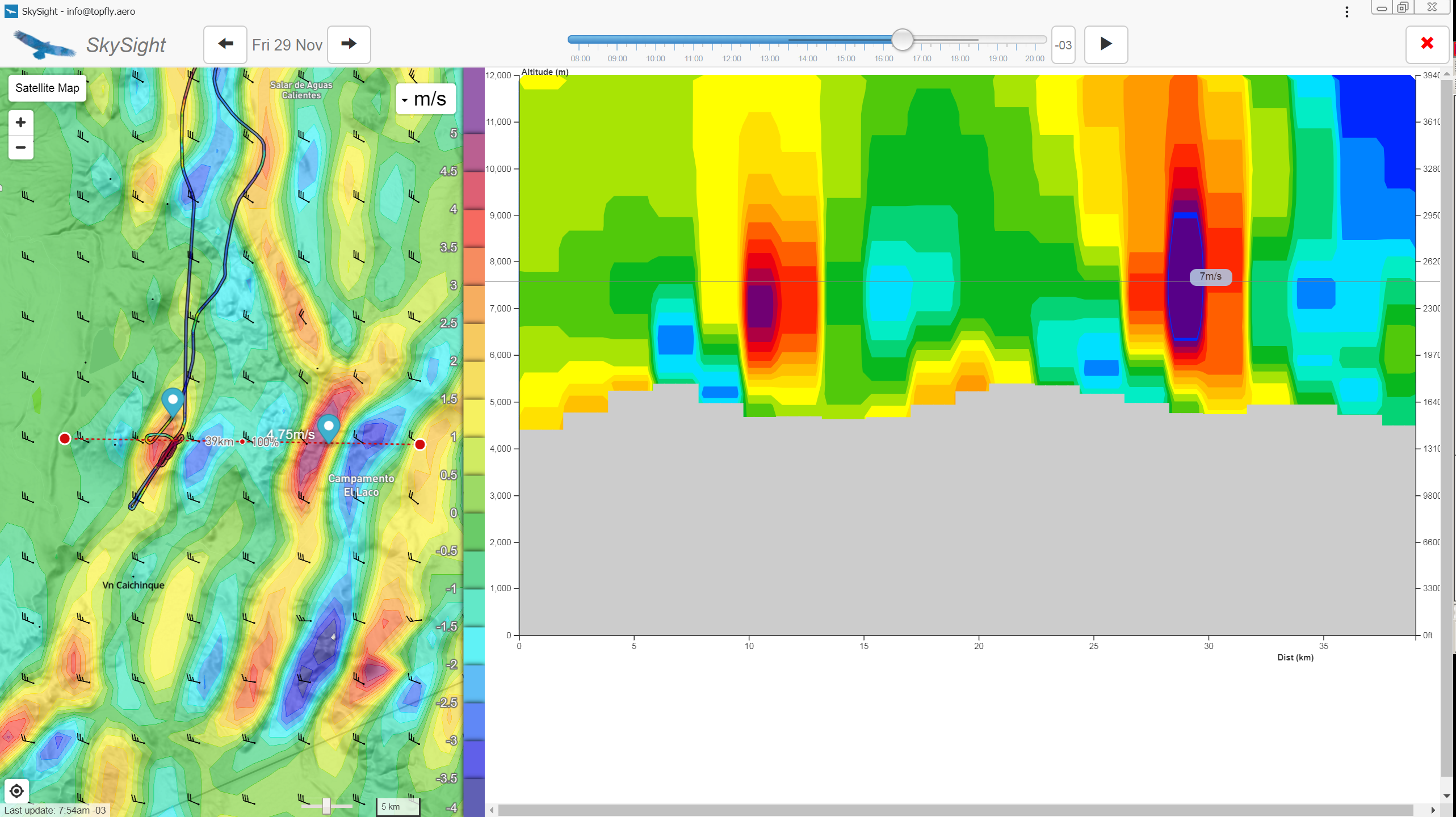
Generating cross sections is an innovative function of SkySight. It also gives an idea of the altitude at which we can hope to catch the lift of the rebound (here 500 m AGL at the first rebound, i.e. 5,000 m MSL), and up to what altitude we can expect to climb and with what values, in this case more than 12,000 m at the 2nd rebound with up to 7 m/s (verified!)
